This article was published in the peer-reviewed journal Marine Intellectual Technologies, No. 2, part 1, 2025, p. 202.
We have abridged it, keeping the material that has practical value. You can read the full text of the scientific paper (in Russian) at this link.
Introduction
With the worldwide progress in microelectronics and robotics, and given the significant advances in this field, there is now a growing interest in carrying out a variety of dangerous and technically complex jobs with robotic platforms that are built on sophisticated electronics and high-precision sensors and controlled by smart algorithms.
In turn, the high level of technological development, together with increased production capacity, has made such equipment cheaper and therefore more widely available on the market.
Underwater engineering work is no exception. The appearance of compact underwater vehicles that one person can carry, together with a wide range of useful add-on equipment, has made it possible to start experimenting with such robots for surveying water areas and various hydraulic structures.
The aim of these experiments is to replace the heavy and dangerous work of divers with robots wherever possible.
This paper gives a brief overview of the tasks that divers perform, the trends in underwater robotics aimed at solving them, and experience of using a remotely operated underwater vehicle to survey a berthing structure and the adjacent water area.
Trends and prospects for using underwater drones to inspect underwater objects
Underwater robotics is developing actively to solve practical problems. The main reasons are:
- the growing use of underwater drones in the military and security sectors;
- the increasing use of remotely operated unmanned underwater vehicles in underwater scientific research and in search-and-rescue and repair work.
The limiting factors are the price of such robots and the high risk of losing them.
The main types of underwater vehicles are:
- Remotely operated underwater vehicles (ROVs) – robots that an operator controls in real time. A special cable (tether) provides the link between the control station and the vehicle;
- Autonomous underwater vehicles (AUVs) – robots with a built-in battery that carry out a strictly predefined program underwater, for example surveying a given square of a water area.
ROVs are the most widely used underwater robots.
The main tasks that can be solved with ROVs are:
- creating detailed maps of the seabed before underwater infrastructure is built;
- monitoring the seabed in ports, detecting underwater objects and determining their exact position to ensure safe navigation;
- monitoring the chemical composition of seawater and assessing drinking-water quality in reservoirs;
- search-and-rescue and other emergency work in natural and man-made disasters;
- scientific research on lakes, seas and the ocean floor;
- meteorological observations.
The design of an ROV allows a wide variety of instruments, sensors and manipulators to be mounted on it.
Over the long history of underwater vehicles, well-established practices have emerged for using various hydroacoustic instruments on them. ROVs most often carry scanning sonars, which are used to inspect underwater objects in turbid water, and various positioning systems, mostly ultra-short baseline (USBL) systems that determine the vehicle's coordinates while it works. AUVs carry side-scan sonars (SSS), which scan the bottom and, thanks to the vehicle's steady movement along its course, produce a clear, easily readable sonogram – an image of the bottom without serious distortion. For positioning, AUVs more often use inertial systems combined with a Doppler velocity log (which work underwater) and a GPS sensor (which works on the surface, when the vehicle surfaces periodically). This is how dead reckoning is done and a relative track of the vehicle's movement is built.
This paper presents a new approach to surveying a water area: using an SSS on an ROV together with an installed USBL underwater positioning system. There is not much work on this subject, which is explained by the difficulty of keeping the vehicle stable on its course (ROVs are usually frame structures that are not hydrodynamically shaped). A high-quality sonogram can be obtained only from an ROV with a stabilization system that lets it hold its course with minimal deviation. Using an ROV with a hydrodynamic shape and low drag in the water would solve this problem.
Using such ROVs when divers survey hydraulic structures can significantly improve the results of the survey and minimize the risks of hazardous work.
Experience of using underwater drones at oil and gas facilities
One prominent example of the successful use of an underwater drone was a survey of the seabed and of the underwater part of the berthing structures at an oil industry facility. It was carried out by Applied Geodesy and Metrological Control LLC together with Rosgazifikatsiya JSC using the Trionix-6M remotely operated underwater vehicle (ROV), equipped with the ultra-short baseline hydroacoustic navigation system (USBL) Zima2.
The work was carried out in late December 2024. Conditions:
- Air temperature (daily average): -8 °C
- Water temperature: +2 °C
- Current speed: up to 0.5 m/s
- Underwater visibility: up to 2 m
- Bottom: sandy
- Ice cover, including ice buildup: up to 10 mm
In surveying the berthing structure, the following tasks had to be solved:
- Survey the water area adjacent to the berthing structure with the side-scan sonar (SSS) mounted on the ROV;
- Survey the underwater part of the berthing structure with the SSS mounted on the ROV;
- Inspect the underwater part of the berthing structure with the ROV's video camera;
- Analyze the data obtained with the SSS and determine the GPS coordinates of potentially hazardous objects;
- Send the ROV to the coordinates where the SSS data had identified potentially hazardous objects, and inspect those objects with the ROV's video camera.
A survey plan was drawn up before the work began, and the ROV team followed it strictly. The work took two working days, with an average shift of no more than 8 hours.
The team members directly involved in operating the ROV were:
- Team leader;
- Lead ROV operator;
- Backup ROV operator.
The team leader oversees the execution of the work plan. The lead operator pilots the drone while monitoring its parameters and the SSS readings. The backup operator supports the operation of the ROV: watches how the tether behaves and launches and recovers the ROV. If necessary, the backup operator can take over control of the ROV, in which case the team leader takes over the backup operator's duties. A team of three is therefore fully self-sufficient and effective.
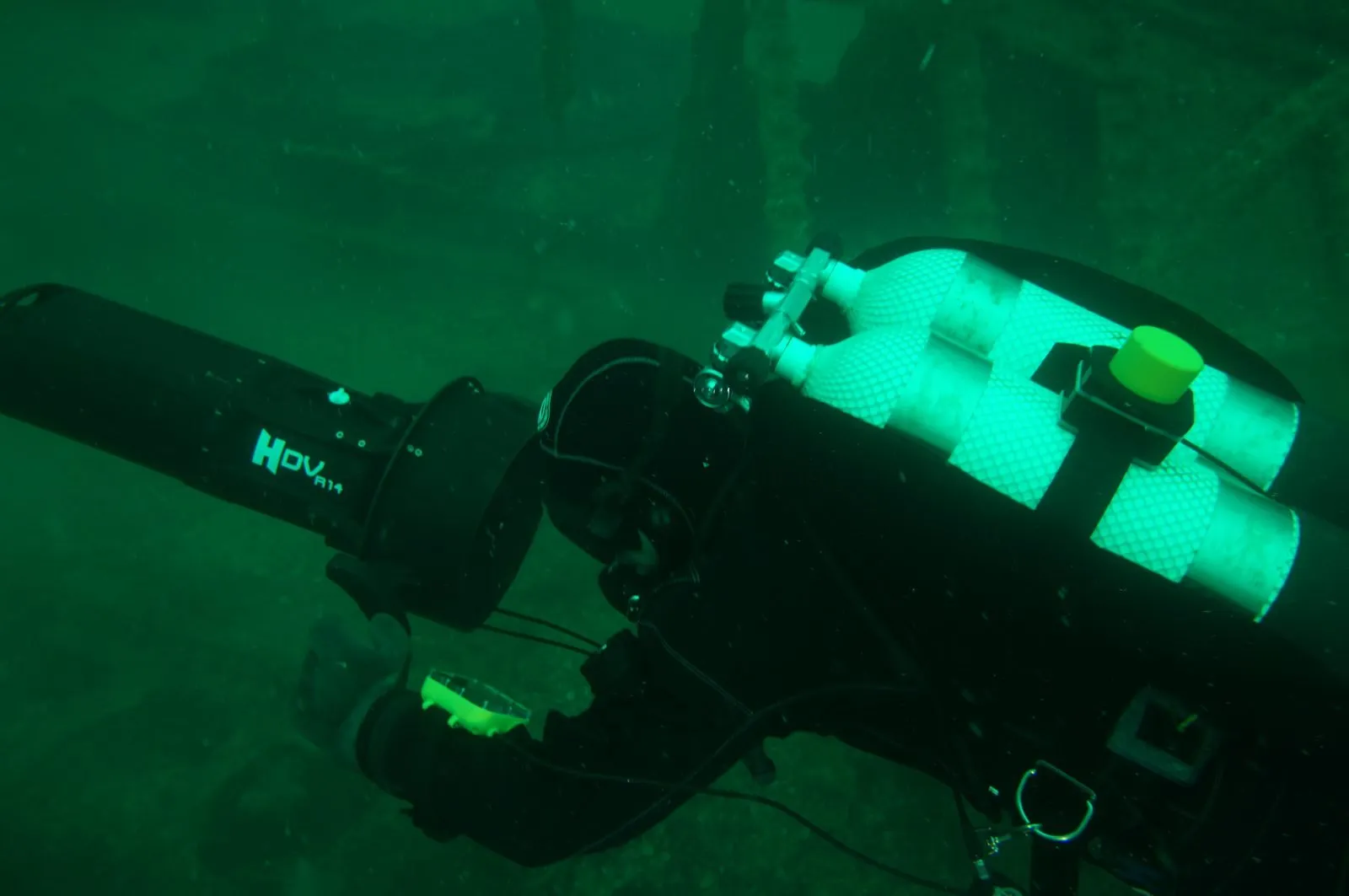
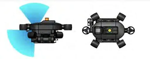
The work used a compact Trionix-6M ROV. It is a Russian-made vehicle with its own line of auxiliary equipment for underwater work: a two-degree-of-freedom manipulator, a hydroacoustic positioning system and a side-scan sonar.
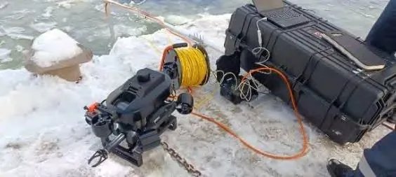
The integrated Zima2 hydroacoustic system provides underwater positioning: it determines the GPS coordinates of the ROV while it is submerged. The system has a hydroacoustic communication channel and is an ultra-short baseline (USBL) system. It works as follows: a direction-finding antenna is installed on the shore at the ROV launch point or on a support vessel, and a hydroacoustic beacon is mounted on the ROV. A complex acoustic signal is used to measure the distance between the antenna and the beacon, as well as the ROV's azimuth. The system measures the vehicle's relative position. A GNSS receiver installed next to the antenna obtains the antenna's GPS coordinates and heading. This makes it possible to obtain the ROV's GPS coordinates as well.
At industrial facilities with high security requirements, the satellite signal is often jammed. In that case the system can work without a GNSS receiver: the antenna's coordinates and orientation angle are entered manually, using a map and various landmarks – for example, the angle of the berth.
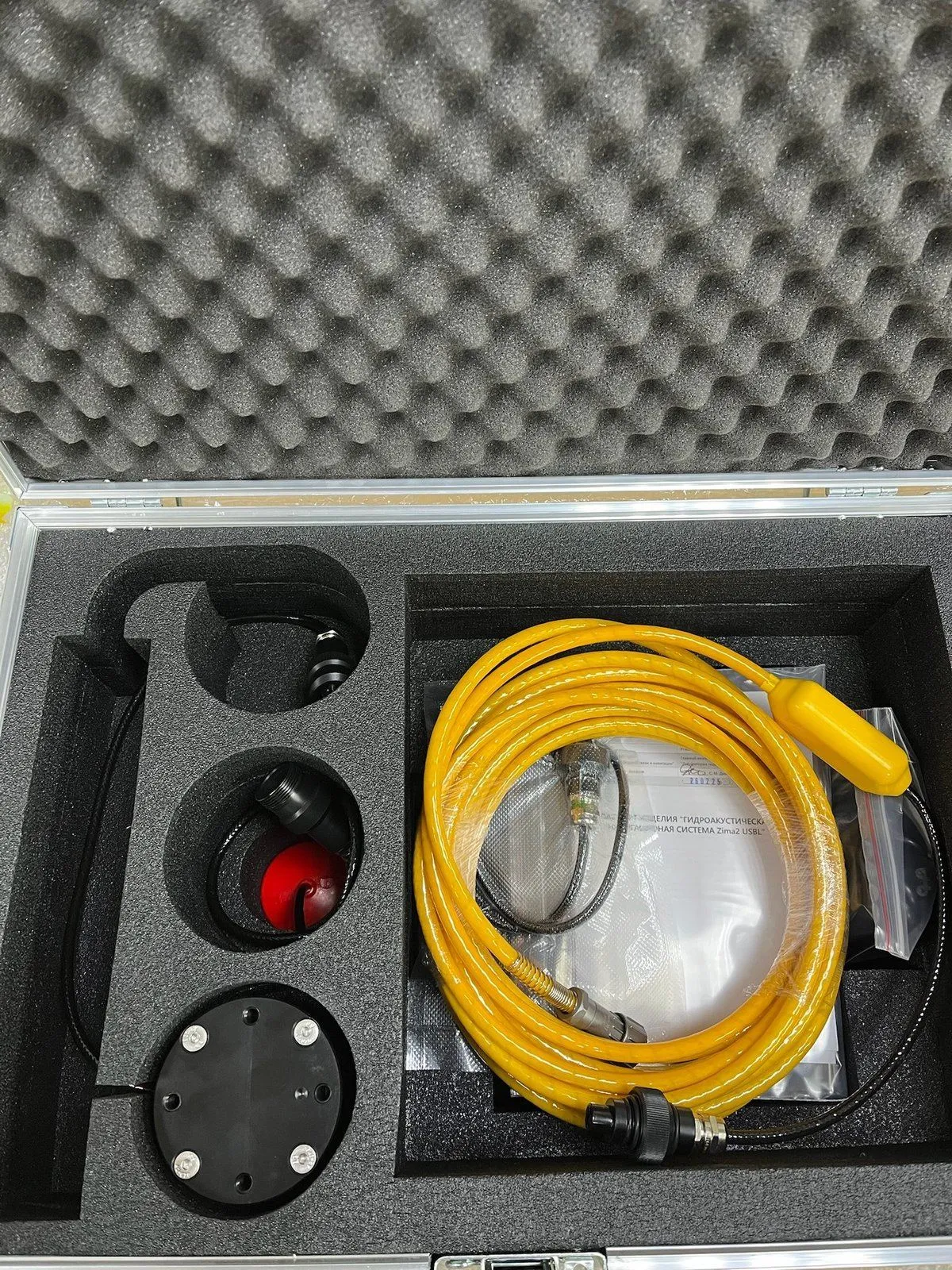
The working kit of the Zima2 system consists of the following elements:
- Direction-finding antenna;
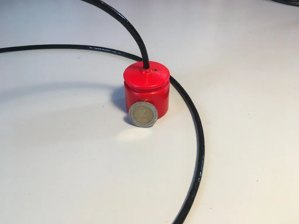
- Beacon for mounting on the ROV;
- Shore control module with a battery.
The system is integrated into the software of the Trionix-6M ROV. The operator can see a mini-map showing the ROV's position and the track it has covered. The mini-map is located in the vehicle's user interface. It is also possible to open a larger map:
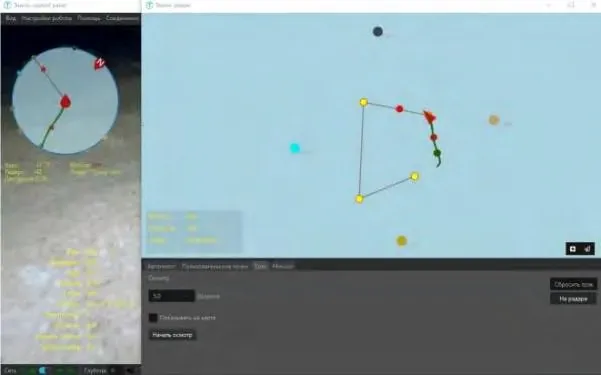
Thanks to the wide swath, search work with an SSS is among the most efficient, because it lets you survey large areas of water quickly and with high quality.
The SSS survey of the water area revealed three groups of potentially hazardous objects. The SSS image makes it possible to identify objects from the sonogram, but a full understanding comes only from detailed video footage.
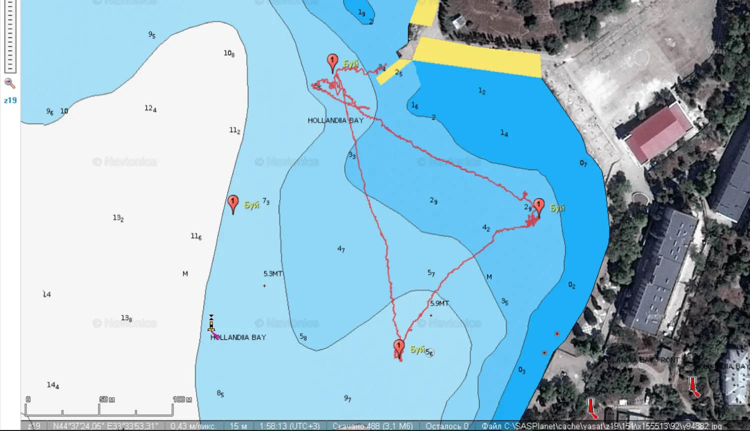
The Zima2 navigation system tracks the location of the ROV throughout the survey. The ROV's track is recorded while the work is under way. After surveying the water area, the operator carries out an additional inspection of the objects that were found, using the recorded coordinates. The result of the ROV team's work is a report with photographs, acoustic images and the coordinates of the objects, along with their descriptions. The data obtained can be analyzed to draw conclusions about whether there are objects that would obstruct the berthing of a vessel.
The ROV's track during the work:
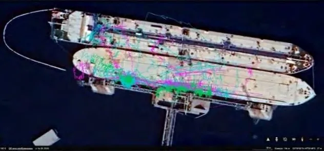
(different colors mark three separate dives)
Next, the structure was fully inspected with the ROV's video camera. In this case there is always an external landmark to navigate by, even in turbid water, so the inspection itself is mostly painstaking work in which each pile is examined visually, one after another. The inspection revealed destruction of the concrete facing layer, with the reinforcement mesh exposed, in the underwater part of the berthing structure. Most of the piles are covered with shell growth, which makes it harder to assess the condition of the structures.
During filming, the ROV's coordinates are recorded, which later makes it easy to return to the defects that were found, regardless of underwater visibility.
The work also produced a map showing the locations of the hazardous objects:
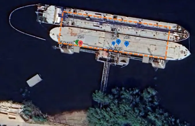
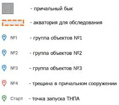
Carrying out such a complex job with the proposed scheme lets you split the whole process into the tasks that a compact underwater vehicle can perform and the part that can be done only by industrial divers or special, complex equipment. This saves time and resources and allows the work to be carried out in line with technical regulations in a more rational way and one that is safer for personnel.
Using an ROV with an integrated underwater positioning system makes it possible to maneuver competently and perform the assigned tasks while always knowing your true position on the map. An important advantage is that all the data is saved, so you can later go back to the required coordinates to carry out the necessary manipulations with a found object.
Using an ROV with an SSS installed makes it possible to survey up to 500 square meters of water area in a single working shift, while keeping the coordinates of the most important points.
Prospects for using underwater drones in the oil and gas industry
The proposed scheme of work is based on the use of ROVs, which are always controlled in real time by an operator who analyzes information about the progress of the survey and decides on further actions. In the future, the operator's functions are expected to be transferred to artificial intelligence, and underwater vehicles will be predominantly autonomous.
The development of software that will not only help the operator control the vehicle but also automatically produce the necessary reports once the work is complete will likewise promote the widespread adoption of robotic technologies in the oil and gas industry.
The ability to mount various instruments on ROVs to analyze the condition of the seabed and of water bodies will make it possible to obtain more reliable information. Modern approaches to underwater surveys involve a wide range of technical means and instruments, such as SSS, multibeam echo sounders, scanning sonars, bottom profilers, magnetometers and other sensors. Even now, this concept makes it possible to obtain a nearly three-dimensional model of a submerged object.
Given the results of a geodetic survey, it is easy to tie them to the ROV's coordinate grid, which improves the accuracy with which defects are recorded and makes it possible to measure deviations of the structure's load-bearing elements from their design position.