We recently tested a new long-baseline navigation system, or rather a prototype of one. The trials were held on the V. I. Lenin Volga-Don Shipping Canal, with a guaranteed depth of 3.75 m.
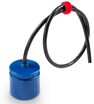
We positioned a pinger that could later be mounted on a robot or a diver, letting you track its location on a map in real time and record its path. We used the world's smallest hydroacoustic modem, uWave, with alternative firmware, as the pinger.
We set up four base points that received the hydroacoustic navigation signal, synchronized with GPS, and sent the arrival time and the received packet over a radio link to a laptop. Each base point was built very simply. It consisted of a plastic box (a future hydroacoustic buoy) containing a radio module with an antenna, a GPS module, and a DC-DC converter, all powered by an ordinary lead-acid battery, plus a navigation receiver that held all the processing logic.
The system worked perfectly. Watch the video to see how we set up the base stations and what data we got. As an experiment, we also tried placing the pinger outside the base, to see how the whole system would perform under those conditions. You can see the resulting data in the video as well: